
CO2 Matrix: Today we look at another area where major oil fields can be tied
to downwind droughts: Alaska and the Northwest.
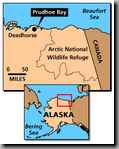
Alaska's Prudhoe Bay was the biggest oil field discovered in America.
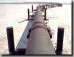
When Prudhoe Bay went on line, the Alaskan Pipeline carried oil--not natural
gas--down south to waiting tankers, e.g., the Exxon Valdez.
While the oil was transported via the pipeline, the ever present natural
gas was flared off into the atmosphere.
Given the correlation of oil fields and downwind local warming, it should
not be a surprise that Alaska has experienced the greatest temperature rise
in the last 30 years. While the world's temperature has increased one degree,
Alaska has increased seven degrees.
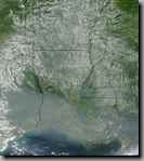
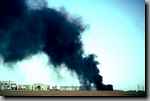
With heat and drought, comes forest fire. This is a satellite image of smoke
from an Alaskan fire over New Orleans, Louisiana. This is further proof that
CO2 plumes stay together and travel great distances.
The prevailing wind pattern or jet stream over the western part of North
America is called the Alberta Clipper. This image shows it traversing Canada
into the US. What is the name of the hockey team in Edmonton Alberta?

The Edmonton Oilers. And, where does the jetstream go that is named for Alberta
and goes over Canada's oil fields?
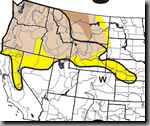
Over the US Northwest that has a drought since the late 1990s that corrresponds
with upwind oil field development.
This rising drought has corresponded to the rising production of Canadian
petroleum.
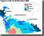
A funny thing about droughts is how they don't recognize political boundaries.
The US northwest drought is part of a larger drought that has a Canadian
half.
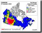
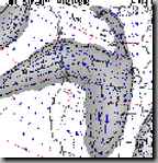
As one would expect, if versed in the CO2 Matrix, the northwestern drought
would would have fires like the African drought as shown in this image. US
fires in the West are mentioned less and less as become more and more common.
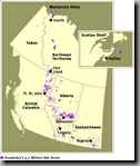
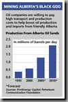
Further buttressing the contention that droughts emanate from oil fields
is this picture of Canadian oil fields that is a close fit to the previous
map of Canadian drought and fire map.
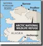
Clearly, if the CO2 Matrix is a reality then opening up the Artic National
Wildlife Refuge to oil wells will cause more local and global warming. So
that the 48'ers can have bone-chilling air-conditioning and bone-crushing
SUV's, will Alaskans see their way of life melt and burn away?
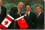
Alaskans may derive some sense of revenge from the Chinese buying more and
more of Canadian petroleum which will, courtesy of the Alberta Clipper, dryout
and burn the Western United States. Globalization means Oil to China and
CO2 to US.

Because CO2 recognizes no political boundaries, then environmental economics
of droughts, floods, and fires trickle down and across nations. Tomorrow,
we will analyze the CO2 matrix impact on the Richmond, Virginia, area.